Explore the historical geography of Armenia through a curated selection of ancient, medieval, and modern maps. These cartographic resources provide visual insight into the shifting boundaries, political entities, and cultural centers that have defined Armenia and its surroundings over millennia. From ancient kingdoms to the First Republic of Armenia and modern borders, each map offers a window into a specific chapter of Armenian history.
Ancient World Maps (City-States, Empires, Civilizations etc)
This section features maps depicting Armenia in the context of the ancient Near East and classical antiquity. It includes representations of Urartu, the Kingdom of Armenia under Tigranes the Great, and Armenia’s interactions with major powers such as Persia, Rome, and the Hellenistic kingdoms. These maps help trace the early development of Armenian identity and territorial formation.
Maps of Medieval Armenia and Its Neighbours
Here you will find maps illustrating the geopolitical landscape of the Asia Minor, Armenia, Caucasus and surrounding regions from the 5th to the 15th centuries. The maps include depictions of the Bagratid Kingdom of Armenia, the Armenian Kingdom of Cilicia, and interactions with Byzantium, Seljuks, Mongols, and others. They reflect the resilience of Armenian statehood during periods of fragmentation and foreign domination.
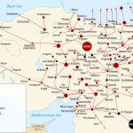
Maps of Armenia
A collection of historical and modern maps of Armenia, from early cartographic depictions to Soviet-era borders and today’s Republic of Armenia. This section includes the original “Maps of Armenia” page from the 2006 version of Armenian-History.com, later updated to provide better visual clarity.